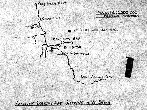
Map of "Locality sketch Last Sighting of Lt. Smith" loss of P-38H 42-66493 piloted by 1st Lt. Paul Smith
Annotations include a dot indicating "Lt. Smith last seen here" also indicated is a line of the coast of the north coast of New Guinea with Cape Ward Hunt, Caution Point, Opi River, Holnicote Bay (Gona), Gona, Gona Wreck [Ayatosan
Maru], Cape Killerton, Cape Endaiadere, Buna and Dyke Auckand Bay. Scale 1:1,000,000 Mercator Projection
Credit: MACR 1846 page 9 Date: November 8, 1943
Map
High Resolution Version
Acquire This Image |
Contribute
Information
Do you have photos or additional information?
Make A Donation | Previous Page | Pacific Wrecks |