Location
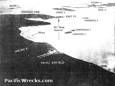
Asie Island is located in the Fauro Island Group (Fauro Islands) in the northern Solomon Islands. The hills at the center of the island have an elevation of 117' and 144'. At the northern tip is an elevation of 94'. On the eastern side is Iriua Point and Kareki Point. The southeastern corner is fringed by coral reefs. The northern edge of the island is also fringed by coral reefs and includes Kahelea Point. To the northwest is Taurato Island. To the east borders Popotoa Island, Baobi Island, Kavakava Bay and Fauro Island. To the west is Tomase Island and Ballale Island. To the south is Ruria Island. Prewar and during the Pacific War part of the British Solomon Islands Protectorate (BSIP). Today located in in Western Province in the
Solomon Islands.
Contribute
Information
Do you have photos or additional information to add?
Last Updated
November 16, 2022
|