|
|
|
| Missing In Action (MIA) | Prisoners Of War (POW) | Unexploded Ordnance (UXO) |
| Chronology | Locations | Aircraft | Ships | Submit Info | How You Can Help | Donate |
|
 USAAF August 6, 1942 |
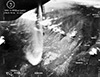
Location Oivi is a prewar village located along the Kokoda-Buna Road (Kokoda Highway) along the Oivi Creek, roughly five kilometers west of Gorari in New Guinea. Prewar and during the Pacific War located in the Northern District (Northern Province) of the Territory of Papua. Today located in Oro Province in Papua New Guinea (PNG). Wartime History After the Japanese landing on the north coast on July 21-22, 1942, they advanced to the Oivi area by July 25 then and advanced towards Kokoda. After their withdrawal over the Kokoda Trail, the Japanese established defensive positions the Oivi-Gorari area. During early November 1942, the Australian Army advanced towards Oivi and met resistance roughly 1.5km west of Oivi from a forested areas where a Japanese force of approximately 2-3 battalions established machine gun positions and sniper positions in the trees, supported by mortars and mountain guns. On November 6, 1942 when the Australians began probing these positions they sustained 17 KIA and 36 WIA. Instead of continued frontal attacks, the Australians used a parallel track to the south in at attempt to outflank the position over the next several days before attacking again during November 9-12. During the assault, the Japanese suffered approximately 1,000 casualties. The Australians suffered 130 KIA and over a hundred WIA. Allied missions against Oivi August 3, 1942–November 9, 1942 Today Australian foxholes and weapons pits are located to the south of the village. References Field Guide to the Kokoda Track (2006) pages 398-404 Contribute
Information Last Updated
|
| Discussion Forum | Daily Updates | Reviews | Museums | Interviews & Oral Histories |
|