|
|
|
| Missing In Action (MIA) | Prisoners Of War (POW) | Unexploded Ordnance (UXO) |
| Chronology | Locations | Aircraft | Ships | Submit Info | How You Can Help | Donate |
|
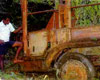 1970s  Justin Taylan 2000 |
Location Lat 3° 36' 0S Long 143° 41' 60E Brandi is located on the north coast of New Guinea. Borders Boram Bay to the north and the Brandi River to the west. To the northwest is Cape Moem and Dove Bay further to the west is Wewak. Prewar Wartime History American missions against Brandi Brandi
High School Contribute
Information Last Updated
|
Map Fallingrain |
| Discussion Forum | Daily Updates | Reviews | Museums | Interviews & Oral Histories |
|