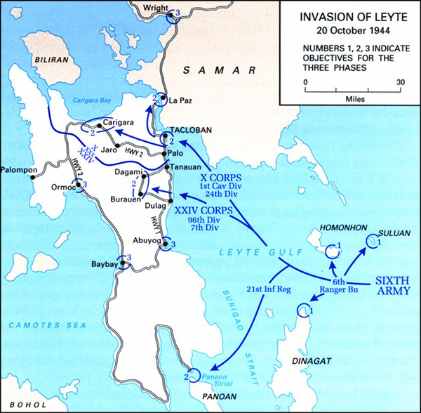
Map of the Invasion of Leyte
U.S. Army landings include the objectives of Leyte for the three phases: 1, 2 and 3. Blue arrows indicate the three amphibious landings. Sixth Army, 6th Ranger Battalion at Suluan, Homonhon and Dinagat.
Also a landing by the 21st Infantry Regiment at Panoan. X Corps 1st Cavalry Division, 24th Infantry Division landing at Tacloban and Palo and Tanauan. XXIV Corps 96th Infantry Division and 7th Infantry Division landing at Dulag. The map also indicates Leyte Gulf, Leyte, Carigara, Carigara Bay, Jaro, Dagami, Ormoc, Ormoc Bay, Palompon, Abuyog, Baybay, Surigao Strait, Samar, La Paz, Wright, Camotes Sea, Biliran, Bohol, Panoan Strait.
Credit: U.S. Army Date: October 20, 1944
Map
High Resolution Version
Acquire This Image |
Contribute
Information
Do you have photos or additional information?
Make A Donation | Previous Page | Pacific Wrecks |