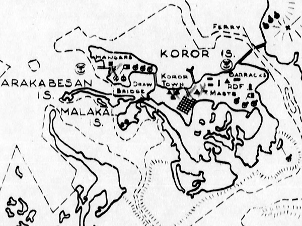
Map of Koror Island (Oreor) in central Palau (Belau)
Borders Arakabesan Island (Ngerekebesang) and Malakal Island (Ngemelachel) to the west, Urukthapel Island to the southwest and Babelthuap Island (Babeldaob) to the northeast and to Palau Harbor (Palau Anchorage, Koror Roads) to the east.
Credit: USN Date: March 30, 1944
Map Enlargement
High Resolution Version
Acquire This Image |
Contribute
Information
Do you have photos or additional information?
Make A Donation | Previous Page | Pacific Wrecks |