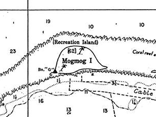
Map of Mogmog Island at the northern edge of Ulithi Lagoon (Urushi Lagoon) in Ulithi Atoll
Indicated is Mogmog Island (Recreation Island) and underwater cable and the fringing coral reef. To the south is Ulithi Lagoon (Urushi Lagoon) and the "seaplane area" for take off and landing by seaplanes and flying boats at the northern edge of the anchorage.
Credit: USN Date: June 1945
Map Enlargement
High Resolution Version
Acquire This Image |
Contribute
Information
Do you have photos or additional information?
Make A Donation | Previous Page | Pacific Wrecks |