Missing In Action (MIA)
Prisoners Of War (POW)
Unexploded Ordnance (UXO)
Chronology
Locations
Aircraft
Ships
Submit Info
How You Can Help
Donate
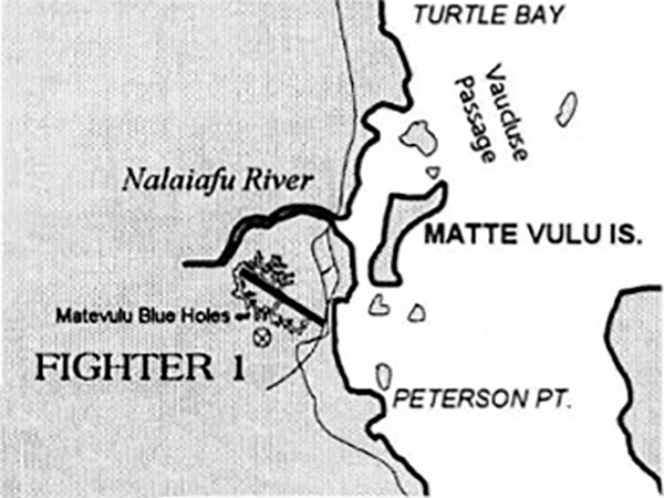
Map of
Fighter 1 (Turtle Bay Airfield)
on the eastern coast of
Espiritu Santo
circa 1942
Indicated are
Fighter 1 (Turtle Bay Airfield)
, Matevulu Blue Holes,
Matte Vulu Island
, Peterson Point, Vaucluse Island, Vaucluse Passage, Turtle Island, Bossy Island and
Turtle Bay
on the eastern edge of
Espiritu Santo
. At the far right is the edge of
Mavia Island (Mafia)
.
Credit:
The Lady and the President
Date: 1997
B&W
High Resolution Version
Acquire This Image
|
Contribute Information
Do you have photos or additional information?
Previous Page
Discussion Forum
Daily Updates
Reviews
Museums
Interviews & Oral Histories
Pacific Wrecks Inc.
All rights reserved.