|
|
|
|
| Missing In Action (MIA) | Prisoners Of War (POW) | Unexploded Ordnance (UXO) |
| Chronology | Locations | Aircraft | Ships | Submit Info | How You Can Help | Donate |
|
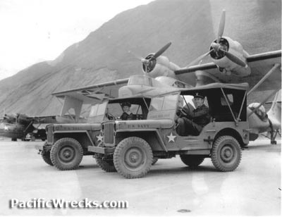   USN c1943 |
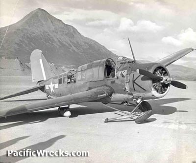
Location Lat 57° 45' 0N Long 152° 29' 38W Kodiak Airfield is located at an elevation of 78' above sea level at Fort Greeley on Kodiak Island in Alaska in the United States. Also known as Kodiak Naval Air Station or NAS Kodiak. During World War II, the U.S. Army Airfield referred to the airfield as Fort Greeley. Construction Built prewar by the U.S. Navy (USN) at Fort Greeley after the completion of Sitka Seaplane Base. The facility had a seaplane ramp and runway known as Kodiak Airfield were both completed by June 15, 1941. The supporting facilities included hangers and buildings. Wartime History During World War II, Kodiak Naval Air Station was used by U.S. Navy floatplanes including OS2U Kingfishers and PBY Catalinas. The runway, American units based at Kodiak VS-56 (OS2U) - December 1944 VS-70 (OS2U) - December 1944 VS-49 (OS2U) - December 1944 VS-48 (OS2U) December 1944 - August 1945 54th FG, 42nd FS (P-39) Harding Field arrives June 12, 1942–September 8, 1942 departs Adak 54th FG, 57th FS (P-39 detachment) Elmendorf arrives September 30, 1942 28th CG, 36th BS (B-24) Elmendorf arrives February 9, 1942–May 4, 1943 departs Amchitka Postwar On April 17, 1947 a U.S. Coast Guard (USCG) Air Station was commissioned at NAS Kodiak with an air detachment that operated a single PBY Catalina manned by seven pilots and thirty crew. On July 1, 1971 the U.S. Navy (USN) turned all airport runways and areas on the northern side over to the State of Alaska. The rest of the base was turned over to the U.S. Coast Guard (USCG). Today Still in use today as Kodiak Airport that serves as a dual military (USCG) and civilian airport with three runways. The first oriented 25/07 measures 7,542' x 150' surfaced with asphalt. The second oriented 29/11 measures 5,399' x 150' surfaced with asphalt. The third oriented 36/18 measures 5,013' x 150' surfaced with asphalt. Airport codes: FAA: ADQ / ICAO: PADQ / IATA: ADQ. Seaplane Ramp The seaplane ramp remains overgrown and disused since the war. Hangers World War II era hangers remain in use to this day. Memorial Star On the slopes of Old Women's Mountain, across the road from the main gate to the base, there is a star which is lighted during the Christmas season. At the base of this star there is a memorial stone, engraved "In memory of all military personnel who have given their lives while engaged in operations from Kodiak 30 November 1980." Contribute
Information Last Updated
|
Map Fallingrain |
| Discussion Forum | Daily Updates | Reviews | Museums | Interviews & Oral Histories |
|