 |
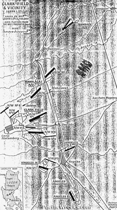
Map of Clark Field area of Luzon in the Philippines
Based on Map of Luzon, airfields from photos taken September 21, 1944. Visibile are Camp Stotsenburg to the west of Clark Field (Runway No.1, Runway No. 2, Runway No. 3, Runway No. 4, Runway No. 5, Runway No. 6.), Angeles (North-East, No 1, No. 2, Angeles, Angeles South), Mabalacat (No 1 and No. 2) and Bamban to the north.
Credit: US Army Date: September 21, 1944
Map
High Resolution Version
Acquire This Image |
Contribute Information
Do you have photos or additional information?
Previous Page
|
|