|
|
|
|
| Missing In Action (MIA) | Prisoners Of War (POW) | Unexploded Ordnance (UXO) |
| Chronology | Locations | Aircraft | Ships | Submit Info | How You Can Help | Donate |
|
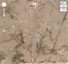 via Google Earth |
Location Lat 4° 34' 36S Long 81° 15' 15W Talara Army Airfield is located to the west of Talara at an elevation of 282' above sea level to the east of the prewar Talara Airfield. Also known as "Talora". Wartime spelling "Talara". Also known as "Talara Field". Today known as Pista De La Fuerza Aerea Peruana. Construction On March 8, 1942 the first American forces arrive at Talara Airfield and construction of barracks and other facilities begins in August 1942. The U.S. Army built a a single runway oriented roughly north to south that measured 8,500' 300'. Wartime History Used by the USAAF, 6th Air Force to defend the South American coastline and for communications. During the war, APO 817. American units based at Talara 336th Service Group 6th BG, 397th BS (LB-30, B-24A, A-17A) August 18, 1942–May 4, 1943 32nd FG, 51st FS (P-40 detachment "D" flight) December 1942–March 9, 1943 departs Seymour 6th BG, 3rd BS (LB-30, B-24A) David Field April 1- May 23, 1943 Salinas 1st PRG, 91st PRS (B-25, F-10) 1943-1944 During July 1944, aircraft ceased using this airfield and most of the U.S. personnel departed. Postwar The U.S. Army 153d Communications Squadron operated a communication station at the airfield until January 31, 1947 primarily to train Peruvian military personnel in communications. Later, further expanded by the Peruvian Fuerza Aérea del Perú (FAP) / Peruvian Air Force. Today Still in use today as Captain FAP Víctor Montes Arias International Airport as a dual military and civilian airport and airpot of entry. The single runway is oriented 35/17 measures 8,038' x 148' surfaced with asphalt. Airport codes: ICAO: SPYL IATA: TYL. References Contribute
Information Last Updated
|
Map 1944 Map Fallingrain |
| Discussion Forum | Daily Updates | Reviews | Museums | Interviews & Oral Histories |
|