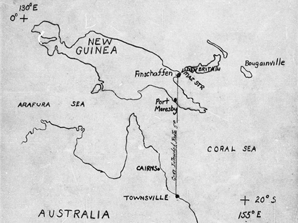
Map showing the intended flight route of C-47A "Windy City" 43-16011
Took off from Garbutt Field at Townsville flying northward with a line indicating the "C-47 intended route 5P" over the Coral Sea bound for Finschaffen in New Guinea. The map also includes Cairns in Queensland in Australia. In New Guinea is Port Moresby, Vitiaz Strait, New Britain and Bougainville. At the lower right is + [registration mark] with [Lat] 20° S [Long] 155° E. At the upper left is + [registration mark with [Lat] with [Lat] 0° [Long] 130° E.
Credit: MACR 14320 page 6 Date: March 27, 1945
Map
High Resolution Version
Acquire This Image |
Contribute
Information
Do you have photos or additional information?
Make A Donation | Previous Page | Pacific Wrecks |