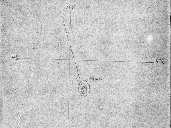
Map depicting the probable flight route of B-24J 42-73148
The map is annotated: "Dotted line above shows course A/P #42-70148 probably flew en route to target from Green Island [Nissan Island]" The dotted line extends to the northwest from Nissan Airfield (Green) on Nissan Island (Green Island) over Green Island Atoll toward the target area of Truk. This bomber took off thirty minutes late at 8:15am. The rest of the formation experienced a severe weather front after take off.
Credit: MACR 14289 page 3 Date: April 2, 1944
Map
High Resolution Version
Acquire This Image |
Contribute
Information
Do you have photos or additional information?
Make A Donation | Previous Page | Pacific Wrecks |