|
|
|
|
| Missing In Action (MIA) | Prisoners Of War (POW) | Unexploded Ordnance (UXO) |
| Chronology | Locations | Aircraft | Ships | Submit Info | How You Can Help | Donate |
|
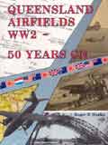 by Roger R Marks R & J Marks 1994 Softcover 277 pages Index, photos maps, appendix ISBN: 0646127691 Language: English
Queensland
Airfields Website Return to |
Queensland Airfields WW2 - 50 Years On During the beginning phase of the Pacific war, the RAAF and USAAF set up a large number of airfields in the Australian state of Queensland. Many of these were previously civilian airfields ‘impressed’ into military service, others were built specifically for military purposes. A large number of these Second World War era airfields have now been converted to civilian and military airfields; others have been bulldozed over and are now used as roads, industrial areas or farming land. This book attempts to show all of the fields used in Queensland during the war, what happened to them after 1945, and what is left of them today. The contents of the book are totally in black and white - this includes photos (both wartime and recent) and a number of very interesting airfield diagrams. The airfields are set out in latitudinal order (that is, from the northern most airfield, to the southernmost airfield) eg, from Horn Island and Higgins, to Archerfield, Amberley and Leyburn. Each airfield has a brief description about its past (if any), the reason for choosing that particular area, why it was named, who used it, when it was decommissioned and what it is (or what’s left of it) now. The Appendices are just as interesting as the body of the book - one gives the details of which nationalities and units served at which airfield and when; another lists how each airfield mapped at the time - on RAAF, USAAF and even Japanese documents. Overall this is a very good book, particularly for those wanting to travel to these airfields, Queensland residents, or anyone who served at any of the airfields documented. Review by Daniel Leahy Return to Book Reviews | Add a review or submit for review |
| Discussion Forum | Daily Updates | Reviews | Museums | Interviews & Oral Histories |
|