|
|
|
| Missing In Action (MIA) | Prisoners Of War (POW) | Unexploded Ordnance (UXO) |
| Chronology | Locations | Aircraft | Ships | Submit Info | How You Can Help | Donate |
|
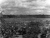  RNZAF c1943 |
Location Lat 15° 31' 60S Long 167° 10' 0E Luganville is located at the southeast corner of Espiritu Santo between Belchif Point to the south and St. Michel Point to the north. Also known as Louganville or Luganvilis. Also known a "Santo" or "Kanal". To the south is Segond Channel and Aore Island. To the south is Million Dollar Point and Scorff Passage. Prewar The Luganville area was a coconut plantation planted with coconut palms harvesting copra. Wartime History Luganville was built by American forces as a port, dry dock and logistical base area to support operations in the Solomons Islands and as a rest and recuperation (R&R) area for American personnel. Thousands of Americans were stationed at Luganville and hundreds of thousands of Americans had R&R during the Pacific War. Today Luganville is the second largest city and the most active port. Many wartime era Quonset huts remain and are still in use. The main street was made four lanes wide to allow trucking traffic from the port into the town. Million Dollar Point At the end of the Pacific War, American forces dumped millions of dollars worth of equipment into the sea. Segond Channel Located to the south of Luganville includes Luganville Seaplane Base. Luganville Seaplane Base Located in Segond Channel with ramp facilities at Belchif Point Bomber 1 Airfield (Pallikulo Field, Fighter 1) Located on the southeastern corner of Espiritu Santo, disused today Bomber 2 Airfield (Pekoa Field) Located on the south-eastern corner of Espiritu Santo, disused today Bomber 3 Airfield (Lungaville Airfield) Located to the wset of Lunganville Contribute
Information Last Updated
|
|
| Discussion Forum | Daily Updates | Reviews | Museums | Interviews & Oral Histories |
|