|
|
|
| Missing In Action (MIA) | Prisoners Of War (POW) | Unexploded Ordnance (UXO) |
| Chronology | Locations | Aircraft | Ships | Submit Info | How You Can Help | Donate |
|
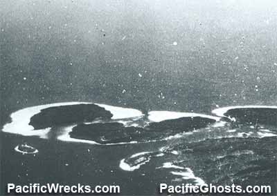 USN October 11, 1943  Justin Taylan 2003 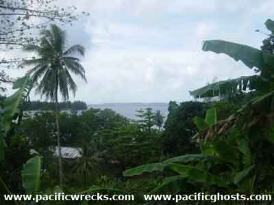 Justin Taylan 2003  Justin Taylan 2005 |
Location Lat 6° 55' 0S Long 155° 52' 60E Shortland Island is the largest island in the Shortland Island Group (Shortland Islands) in Western Province in the Solomon Islands. To the southeast is Kulitana Bay and Faisi Island. To the south is Poporang Island and Tuha Chanel. To the southwest is Magusaiai Island. To the southeast is Shortland Harbor. To the northeast is Ballale Island and beyond to the north is the southern coast of Bougainville. Prewar and during the Pacific War part of the British Solomon Islands Protectorate (BSIP). Today part of Western Province in the Solomon Islands. The entire Shortland Island Group is known as "Alu" in the local language. The Japanese called the island "Shi-you-to-ran-do Shima". Sometimes called "The Shortlands" or "Shortlands" in reference to the entire Shortland Island Group. Japanese code name "RXE". Wartime History On March 30, 1942 around 2:00am, Japanese vessels entered Shortland Harbor and landed two Special Naval Landing Force (SNLF) platoons and met no resistance. One platoon remained in the area to begin establishing Shortland Harbor Seaplane Base. During 1942 the Japanese established a base and fortifications on the eastern portion of Shortland Island until the end of the war. This supported the Shortland Harbor anchorage and Shortland Harbor Seaplane Base. American missions against Shortland Island May 6, 1942–May 15, 1944 Kulitana Bay Located at the southeastern corner of Shortland Island Korovou (Korouvo) Korovou is located on the southeastern side of Shortland Island Lofang (Lofung) Small village on the eastern coast of Shortland Island. Postwar, in the 1970s Alidice Lumber a timber logging operation was based here. Today, the Solomon Islands Police HQ for the area is based here. Harehare Located on the eastern side of Shortland Island. Nankai Located on the southern coast of Shortland Island. Nankai might be a reference to the Japanese term Nanyo (South Seas) to describe this location as on the southern coast of Shortland Island. Contribute
Information Last Updated
|
Map April 11, 1943 |
| Discussion Forum | Daily Updates | Reviews | Museums | Interviews & Oral Histories |
|