|
|
|
| Missing In Action (MIA) | Prisoners Of War (POW) | Unexploded Ordnance (UXO) |
| Chronology | Locations | Aircraft | Ships | Submit Info | How You Can Help | Donate |
|
  U.S. Army 1942 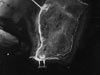 8th PRS December 5, 1942 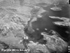 5th AF 1943 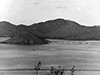 Halmarick Dec 29, 1943 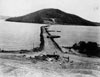 U.S. Army July 1943 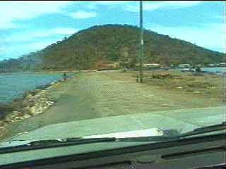 Justin Taylan 2000 |
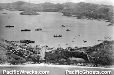
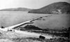
Location Tatana Island is located inside Fairfax Harbor. To the southeast is Hanuabada (Hanuada) and Port Moresby (Town). To the northwest is Motukea Island and to the west across the harbor is Napa Napa. Wartime History During late 1942, the U.S. Army needed more deep water anchorages in Fairfax Harbor to unload Liberty Ships and cargo vessels. By September 1942, a survey was undertaken to check the feasibility of building a causeway from the mainland to Tatana island. In late 1942, a causeway was built by the U.S. Army 96th Engineers (Colored) with African American enlisted soldiers commanded by white officers. By December 1942, a Liberty Ship wharf was constructed on the far side of the island, connected by road to the causeway. Once completed, this causeway was used to transport cargo unloaded from liberty ships to the mainland. Initially, the causeway was only wide enough for a single vehicle. Later, the causeway was expanded to accommodate two lanes for vehicles with a turnaround area. Today The causeway remains in use continual use to this day. References Saturday Evening Post February 12, 1944 Caterpillar advertisement includes a painting of this causeway under construction using bulldozers and U.S. Army troops with the headline "They Pushed Back The Sea". Love, War and the 96th Engineers (Colored) (1995) by Hyman Samuelson pages 87-88 "September 15, 1942 - Completed a survey to see whether it is practical to construct a causeway from Tatana Island to the mainland. Tatana has six fathoms of water within 250 feet of its shore and there is a stretch between it and the mainland, about 700 yards, where the water is hardly more than six feet at its deepest. Colonel Mathews' idea may have merit after all. I think I'll try to get permission to make a reconnaissance in an attempt to find deep water, with a deep approach, within 300 feet or so of the mainland. That would eliminate the causeway construction, might mean building approach roads. The most interesting part of the whole survey was the coral reefs and marine life - what beautiful color and shapes!" Contribute
Information Last Updated
|
Map 1942 Photo Archive |
| Discussion Forum | Daily Updates | Reviews | Museums | Interviews & Oral Histories |
|