|
|
|
| Missing In Action (MIA) | Prisoners Of War (POW) | Unexploded Ordnance (UXO) |
| Chronology | Locations | Aircraft | Ships | Submit Info | How You Can Help | Donate |
|
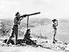 Thomas Fisher July 1942 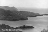 Halmarick Dec 29, 1943 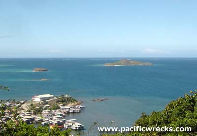 Justin Taylan 2004 |
Location Lat 9° 28' 60S Long 147° 10' 0E Koki is located at an elevation of 26' / 7m above sea level on an outcropping on the southern coast of New Guinea. Also known as 2 Mile or 2 Mile Hill. Borders Walter Bay to the south. Beyond to the southeast is Scone Island, Local Island (Manubada), Scone Island and Nateara Reef. To the east is Badili. To the west is Ela Beach, Port Moresby (Town) and Paga Hill. Prewar An Anglican mission was established at Koki. Wartime History During the Pacific War, Koki was used as a temporary military hospital until late 1943. Known as 2 Mile. Contribute
Information Last Updated
|
Map Fallingrain |
| Discussion Forum | Daily Updates | Reviews | Museums | Interviews & Oral Histories |
|