|
|
|
| Missing In Action (MIA) | Prisoners Of War (POW) | Unexploded Ordnance (UXO) |
| Chronology | Locations | Aircraft | Ships | Submit Info | How You Can Help | Donate |
|
 USAAF May 28, 1943 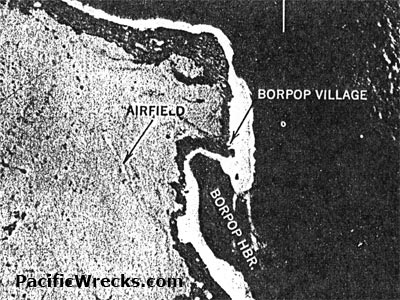 USAAF June 1943 |
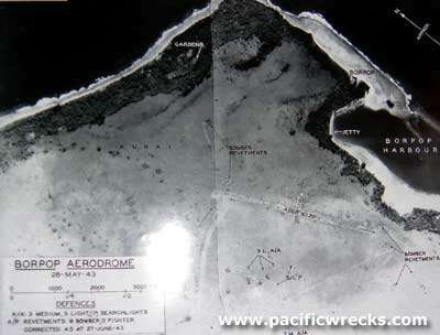
Location Lat 3° 52' 60S Long 152° 49' 0E Borpop is located at sea level on Cape Matanatamberan on the northern coast of New Ireland. Also known as Huris. Borders Borpop Harbor to the south and Borpop Airfield to the west. To the northwest 30 miles away is Namatani. Wartime History In late January 1942 occupied by the Japanese. Sometime afterwards the Japanese built a base area at Borpop and constructed Borpop Airfield. Starting in January 1944 until May 1944 bombed by Allied aircraft including bombers and fighters that neutralized the airfield. Occupied by the Japanese until the official surrender of Japan in September 1945. American missions against Borpop (Huris) January 21, 1944–May 1, 1944 Today A large portion of this area is p property owned by Sir Julius Chan, the 2nd Prime Minister of Papua New Guinea (PM PNG) between 1980–1982 then again between 1994–1997. Borpop Airfield (Huris) Japanese built airfield neutralized by Allied bombing raids Contribute
Information Last Updated
|
Map Fallingrain |
| Discussion Forum | Daily Updates | Reviews | Museums | Interviews & Oral Histories |
|