|
|
|
| Missing In Action (MIA) | Prisoners Of War (POW) | Unexploded Ordnance (UXO) |
| Chronology | Locations | Aircraft | Ships | Submit Info | How You Can Help | Donate |
|
 17th PRS September 11, 1944 |
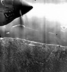
Location Lat 6° 13' 0S Long 155° 37' 60E Kieta is located at the base of the Kieta peninsula on the east coast of Bougainville. Surrounded by Kieta Harbor and Bakawari Island to the east. Nearby is nearby Rigu Mission. Located to the west is Arawa. Also known as "Kieta Town". Prewar In 1902, the Catholic church established a Marist Brothers mission station at Kieta. On September 25, 1095 a German administrative station was added with a post office and customs office to administer Bougainville and Buka in the German Solomon Islands Protectorate administered through Deutsch Neu Guinea (German New Guinea). By 1908 the first commercial coconut palm plantation was established at Kieta. Wartime History On March 31, 1942 at dawn, a platoon of Imperial Japanese Navy (IJN) Special Naval Landing Forces (SNLF) occupied Kieta without resistance after the same force occupied Shortland the previous morning. Afterwards, Kieta was occuplied by Japanese during their occupation of Bougainville and was used as a base area and Kieta Harbor as an anchorage. Starting in late January 1943 attacked by American bombers and later fighters until the middle of 1944. Afterwards, targeted by Royal Australian Air Force (RAAF) and Royal New Zealand Air Force (RNZAF) aircraft until the end of the Pacific War. Kieta remained occupied by Japanese forces until the official surrender of Japan in September 1945. Allied missions against Kieta January 21, 1943–June 14, 1944 Today During the "Bougainville Crisis" most of buildings and infrastructure in Kieta was destroyed. MV Buka Scuttled 1914 into Kobuan Bay near Kieta Kieta Airfield Used by the Japanese during the war. Closed during "Bougainville Crisis". Kieta Memorial Park Memorial park at the town's main intersection. Several memorials, guns, a Japanese Type 89 Tank and recovered Zero is displayed on a pole. Kekere Plantation Located south of Kieta town past Kara Airfield (Toripoil, Buin Airport). Daihatsu Landing Craft Sunk at Kekere in Chivaroi (Orawere Bay). Unknown Japanese Bomber Crashed on coral reef off Kekere, near Kieta. The propeller was salvaged, and then displayed at Aropa Plantation in the 1970s. Aropa Plantation South of Kieta town near Kieta Airfield. Kobuan Bay Located to the north of the Kieta Peninsula. Contribute
Information Last Updated
|
Map 1975 Photo Archive |
| Discussion Forum | Daily Updates | Reviews | Museums | Interviews & Oral Histories |
|