|
|
|
| Missing In Action (MIA) | Prisoners Of War (POW) | Unexploded Ordnance (UXO) |
| Chronology | Locations | Aircraft | Ships | Submit Info | How You Can Help | Donate |
|
 11th AF November 2, 1942 |
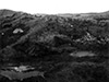
Location Adak Island is the largest island in the Andreanof Island Group (Andreanof Islands) in the Aleutian Island Chain (Aleutian Islands) in Alaska in the United States. Borders Kuluk Bay and Finger Bay. Today Adak Island has restricted public access. Adak Island has an area of more than 280 square miles. Wartime History During the night of June 28, 1942 U.S. submarines landed an advanced reconnaissance parties on Adak. On August 30, 1942, American forces occupy Adak during a raging storm that prevented air cover during the assault. Immediately, they begin building Adak Airfield. Adak became the ACS Headquarters and the largest Army and Navy base in the Aleutians. At the height of the war, 50,000 troops. were stationed on the island. American missions over Adak June 28, 1942–December 3, 1942 On October 1, 1942 a Japanese reconnaissance aircraft confirmed the U.S. presence on Adak Island. Afterwards, the Japanese conducted at last two air raids against the island. Japanese missions against Adak October 1, 1942–October 3, 1942 Finger Bay Deep fjord that borders Adak Island to the west of Sweeper Cove. It is connected by road to the Naval Facility and had extensive docking and other support facilities during WWII. 6" Naval Guns Two 6-inch naval guns overlook Adak Airfield and base area Zeto Point Battery of several 155mm guns emplaced on Panama mounts that remain intact today. Kuluk Bay (Kruluk Bay) An AMTB battery was located at the bay. A total of sixty AA guns were emplaced around Adak at the height of World War II. Radio Station NUD Located at Heart Lake on Adak Island This radio station was call sign NUD and received General MacArthur's surrender order, as sent to the Japanese live, and relayed it on to the United States. Adak Airfield Built by American forces after their occupation in late August 1942. Adak Submarine Pens Located at Finger Bay. Forward submarine base and harbor facility for a small number of submarines and patrol boats during 1943. B-24A Liberator Serial Number 40-2367 Pilot Andrews force landing December 9, 1942 PBY Catalina Wreckage Jerry Craft recalls: "All that I found of the PBY on the southern slope of Adak's Mt. Moffett (probably at about the 1300' to 1500' level) was the distinctive nose section, and that was in the entrance to an ice cave that had formed in the little valley on the mountain's side. My guess is that because I couldn't find any other part of the aircraft, it had probably crashed into the mountain, and the part I found had slid down. The date of this find was probably October, 1947. I don't have any photographs." B-25 Mitchell Wreckage Jerry Craft recalls: The B-25 wreck that I sighted was while on an inspection flight from Adak to Amchitka, sometime in late 1949-early 1950. I believe that our pilot had filed an IFR flight plan for this short hop (most of the flying in those days in the Aleutians was IFR, even if it was an unusually clear day in the region). Our C-47 had been airborne about 30 minutes from Adak, and was probably somewhere near the "Tanaga Intersection" 51.50 N. 178.00 W or about 60 miles due west of Adak. when I sighted the unmistakable wreckage of a B-25 that still bore its WW II olive-drab paint. The island on which it had landed couldn't have been more than a 200-300 feet wide, and 400-500 feet in length. It was quite flat and covered with the tall grass that was common on these islands. The aircraft sat almost exactly in the center of this dinky piece of earth; it was facing east, leading you to believe that it was heading back to Adak. Deep grooves had been made in the earth, almost from the western edge of the island to the place where the aircraft rested. I assumed that these were from the aircraft's engines and propellers. The center of the aircraft, where the wings joined the fuselage, was missing, as though the aircraft experienced a small explosion and/or fire shortly after landing. I went forward in the aircraft and notified the co-pilot of what I'd seen; he said he's note the location in his log. I do not know what, if anything, became of this information. I was never able to relocate this wreck, even though I made several trips through that area in the spring and summer of 1950. In conclusion, all I can add is that pilot of the B-25 made one heck of a landing on such a small target, and I wouldn't be surprised that the crew survived. Whether or not they were ever picked up is another matter." References Page 3, Photos by Chuck Miller 1967/68 (Adak photos) Page 4, Photos by Chuck Miller 1967/68 (Adak photos) Contribute
Information Last Updated
|
| Discussion Forum | Daily Updates | Reviews | Museums | Interviews & Oral Histories |
|